
More Freezing Temperatures Sunday To Tuesday

Tell me if you’ve heard this one before: It’s Friday, and a cold front is moving into South Carolina, bringing rain and, for some, a thunderstorm. Yes, you guessed it – Friday is still Cold Front Day!
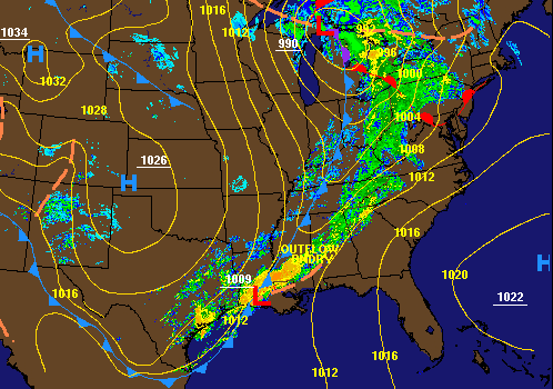 |
The 8 a.m. Friday weather map with radar composite from the Weather Prediction Center showing a cold front causing rain and thunderstorms crossing the Southeast.
The front will slow down as it moves through the state so that coastal areas won’t see rain until later this evening, and the rain will linger at the coast through much of tomorrow.
Another shot of unseasonably cold air will plunge southward behind the front. With an assist from lingering clouds and rain over parts of the state, temperatures will only reach the upper 50s and lower 60s Saturday. Sunday looks even chillier despite the return of sunshine, with highs only in the 50s.
The nighttime lows could be a problem again, as parts of the state could reach freezing from Sunday through Tuesday. It won’t be as frigid as the last cold snap but cold enough to cause potential problems.

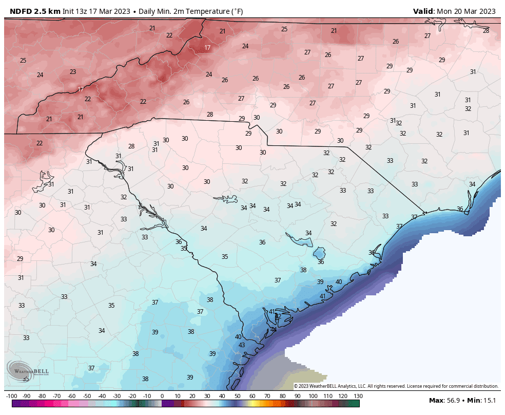
The Sunday morning forecast lows across South Carolina
from the National Weather Service.
Image source: WeatherBELL
Monday and Tuesday mornings look even colder, with mainly clear skies and light winds thanks to an area of high pressure centered nearby. That situation is ideal for heat to radiate from the surface directly into space, so this is how we often get our coldest nights.
The Monday morning forecast lows across South Carolina
from the National Weather Service.
Image source: WeatherBELL
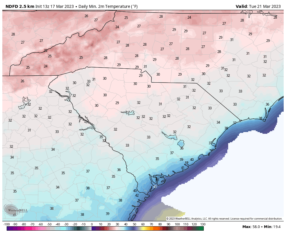
The Tuesday morning forecast lows across South Carolina
from the National Weather Service.
Image source: WeatherBELL
So, you’ll again have to protect any tender plants you have out unless you live along our coast.
A weak storm system will track along the stationary front to our south around the middle of next week. Both the timing and intensity of this weather feature are uncertain right now, but it could bring rain to our coastal areas as early as Tuesday morning, and this rain may linger as late as Wednesday morning. There is also a chance this feature is too weak or tracks too far south to bring rainfall to any part of South Carolina.
Look for a warmup toward the end of next week, but I’ll give you one guess as to what will happen next Friday and next weekend. If you need a hint, see the first paragraph above. One possible difference is that we may see a 1-2 punch of storm systems passing through the eastern part of the country, which would keep us unsettled all weekend. Another cold shot will follow next weekend’s wet weather; hopefully, it won’t get cold enough for any part of the state to see a freeze, but it could be close.